
UN phasing out flawed world map after centuries of use
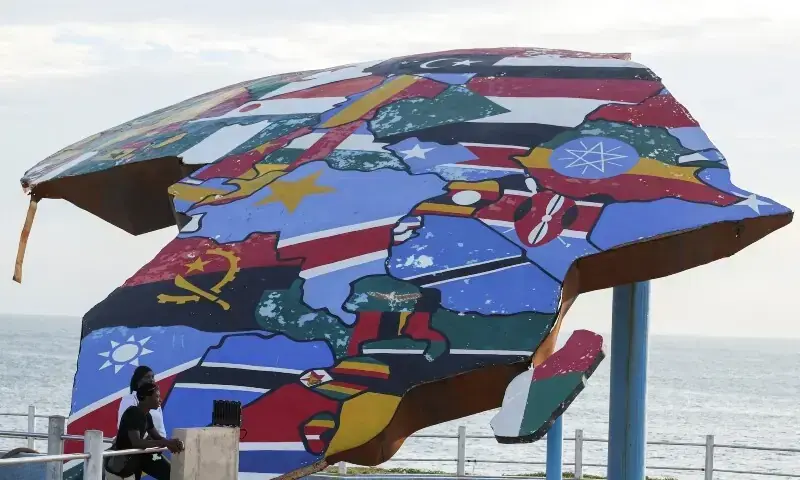

A map is not just a picture of the world; it is a picture of how we understand the world.” That idea has acquired a new significance at the United Nations, where the General Assembly has overwhelmingly backed a resolution calling for a more accurate representation of the size of the world’s continents.
In a remarkable vote, 164 countries supported the resolution, the United States voted against it and six countries abstained. Led by Togo with the backing of the African Union, the initiative seeks to correct the distortions created by the world map that generations have grown up with.
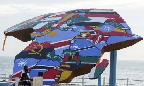
Africa is set to appear much closer to its actual size, while Europe and North America will lose some of the visual prominence they acquire on the familiar Mercator projection. What appears at first to be a technical debate among cartographers has therefore become something much bigger: a statement from the Global South that the map of the world should reflect the world as it exists.
The resolution promotes the wider use of equal-area map projections, including the Equal Earth projection, developed in 2018. The purpose is not to declare one map the only correct map, nor does the resolution ban the centuries-old Mercator projection.
On a conventional Mercator map, Greenland can appear almost as large as Africa. In reality, Africa is roughly 14 times larger than Greenland
It encourages the use of projections that preserve the relative area of continents when the purpose is to understand their actual geographical size. That distinction matters because every flat map of a spherical Earth involves some distortion. The real question is what a map chooses to preserve and what it chooses to distort. The Mercator projection preserves angles and directions, which made it exceptionally useful for navigation. Equal-area projections give priority to preserving the relative size of landmasses. In an age of satellites, GPS and digital cartography, the world no longer needs to depend on one projection for every purpose.
The Mercator map projection revolutionised marine navigation because it allows sailors to plot a straight-line course across the ocean using a single, constant compass heading. Created by Flemish cartographer Gerardus Mercator in 1569, this mathematical breakthrough mapped a three-dimensional globe onto a two-dimensional cylinder. While it heavily distorts the true size of landmasses near the poles, its flawless preservation of angles made it an indispensable, life-saving tool for seafarers.
The distortion becomes obvious when we compare Greenland with Africa. On a conventional Mercator map, Greenland can appear almost as large as Africa. In reality, Africa is roughly 14 times larger than Greenland. The reason is mathematical. As the spherical Earth is projected onto a flat surface, areas become increasingly enlarged towards the poles. Greenland, located close to the Arctic, is therefore dramatically exaggerated, while Africa, much closer to the Equator, appears considerably smaller than its actual area. Europe and North America also acquire a greater visual size, while Africa and South America are compressed.
The map is not “wrong” in the sense that Mercator failed at his original task. It becomes misleading when people use it to compare the actual geographical size of continents. This is where the new UN initiative acquires its political and cultural significance. For the Global South, the problem is not merely that Africa looks smaller on a classroom map. Maps influence the imagination. Children encounter the world first through maps before they learn about population, resources, economic power or political influence. What appears large can unconsciously appear important; what appears small can seem peripheral. A cartographic distortion can therefore become a distortion of perception. The African argument is that a continent whose geographical reality is immense should not continue to be visually diminished simply because a sixteenth-century navigation system became the standard image of the world.
The history of cartography itself demonstrates the relationship between maps and power. Empires mapped territories they controlled; colonial administrations mapped borders, populations and resources; explorers drew coastlines and trade routes; governments used maps to define political space. A map can tell people not only where a place is, but also how that place fits into a larger world. For much of the modern period, global maps were produced and circulated through institutions dominated by Western powers. The Equal Earth projection represents a different cartographic philosophy.
It was designed by Tom Patterson, Bojan Šavri and Bernhard Jenny to show continents in a way that preserves their relative areas more accurately. Africa becomes visibly larger, South America gains its appropriate geographical weight and the enormous scale of Asia becomes more apparent. Europe and North America remain exactly where they are; they simply appear in proportions closer to their actual land area. The new map does not magically produce a distortion-free Earth because no flat projection can do that. It makes a different compromise, one that is more appropriate when the objective is to compare the size of continents rather than navigate across oceans. India’s support for the resolution is significant in this wider Global South context.
The United States, which was the only country to vote against the resolution, strongly criticised the initiative. Washington argued that such a move was unnecessary and questioned the wisdom of the UN spending attention on historical map projections when the world faces wars, economic crises, climate change, migration and other urgent problems. That criticism raises an obvious question: can changing a map really make a difference? The answer depends on what we expect maps to do.
If a map is merely a navigation instrument, the issue may seem trivial. If a map is one of the first tools through which billions of people learn about the world, the question becomes much more important.
Published in Dawn, September 21st, 2026