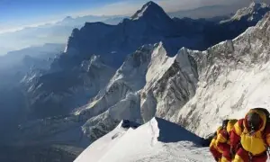

CLIMATE: AFTER THE DELUGE, WHAT?
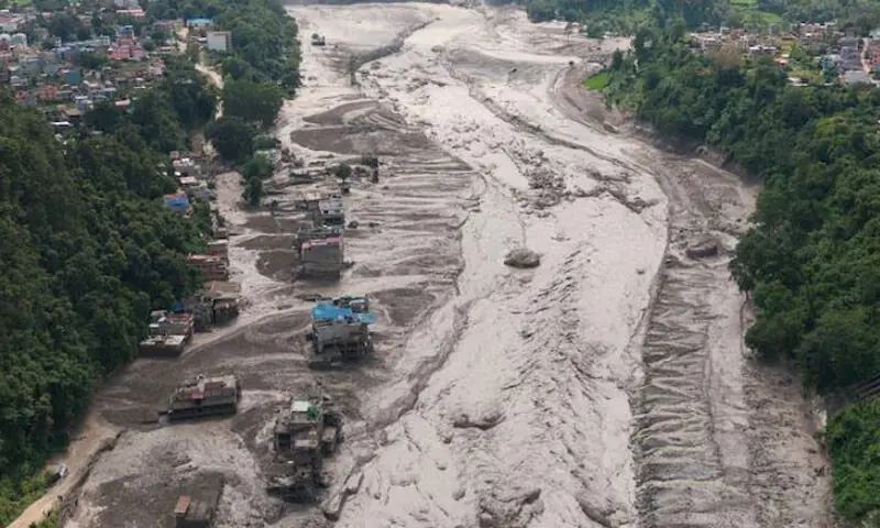

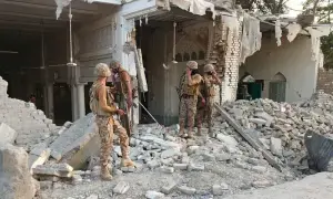
The exact timeline of the recent Nepal flooding disaster is becoming clearer. At 8:37am, instruments recorded what was initially interpreted as an earthquake near Nepal’s border with China. Seven minutes later, CCTV recorded the Gyirong Port border post being destroyed by a massive debris flow and flood.
Nepal’s flood authorities learned about the incident at about 9:00am and sent out an emergency SMS alert at about 9:15am. But by that time, Nepal was already deep into a major disaster.
The 38-minute gap between the tremor being detected and the emergency alert is striking. But it would be wrong to assume Nepal’s authorities could simply have acted on the initial signal: at the time, it appeared to be a small earthquake, rather than a much rarer mountain collapse. The flood also arrived too swiftly for water-level sensors: they went almost immediately from recording normal levels to being destroyed.
The more interesting question is what a better-integrated warning system might have made possible. Could seismic readings, satellite images and other observations have been combined quickly enough to recognise what was happening and alert people further downstream?
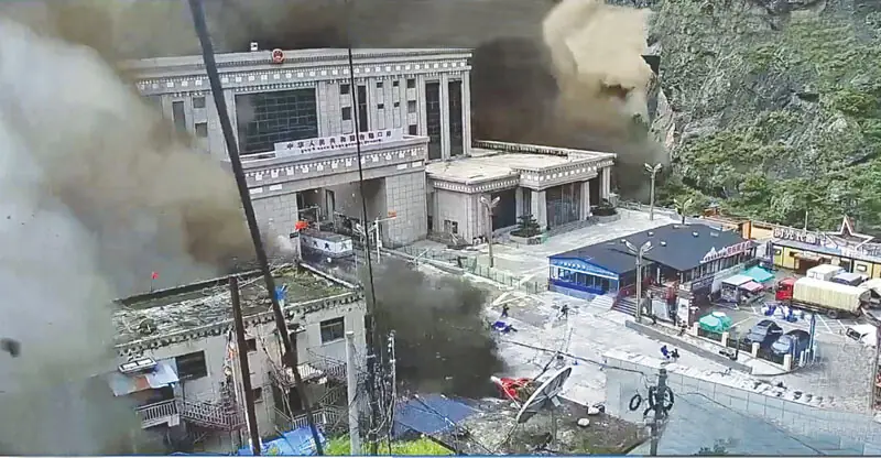
The recent disastrous flash-flood in Nepal that swept away everything in its path and in which thousands are still missing has exposed a gap in existing early-warning systems. As climate change destabilises glaciers and thaws permafrost, such catastrophes are more likely to occur in high-mountain areas. What can be done by countries like Pakistan that will be most affected?
Existing early-warning systems have often been designed around particular hazards, such as regular rain-caused floods or glacial lake outburst floods (Glofs). But this disaster was neither a Glof nor a regular flood. Instead it appears to have involved a rare, large-scale collapse of rock and ice, which turned into a devastating debris flow and flood.
As a recent study of a strikingly similar flood in India last year argued, this type of hazard is largely absent from existing warning frameworks. As warming destabilises glaciers and thaws permafrost, such events are likely to happen more often.
Cascading mountain hazards that cross borders
In July 2025, a glacial lake in Tibet burst and swept down this very same stretch of river into Nepal, killing at least nine people and leaving around 20 missing in Nepal. Eleven people were also officially reported missing on the Chinese side.
After the flood, Nepal and China agreed in principle to share real-time information about floods, landslides and glacial lakes. However, despite Nepal’s foreign minister raising the issue during a visit to China in May 2026, no formal agreement has been signed.
Across the Himalayas and Hindu Kush mountain ranges, rivers, weather systems and infrastructure frequently span national boundaries. Our ongoing research shows a hazard that begins in one place can have lethal consequences — and create new warning requirements — far downstream.
A warming climate is increasing these risks by thinning glaciers, thawing permafrost and destabilising slopes, even if climate change isn’t the sole explanation for every disaster. Meanwhile, roads and hydropower projects are putting more people and infrastructure in threatened valleys.
Cooperation has to come before the disaster
Some cross-border early-warning arrangements already exist between Nepal and its neighbours, particularly for recurring floods. But sudden, cascading events such as the recent disaster pose a different challenge. A warning has value only if it travels the whole distance — from a sensor in the mountains, through scientific agencies, national and local authorities, to households in the valleys and plains below, in the minutes that matter.
Community-based flood warning already works in parts of Nepal’s Koshi basin, where upstream gauges and trained local volunteers buy downstream villages precious time. A regional early warning system would have to link these community-level systems with national and cross-border monitoring, so that information can move from the source of a hazard to the people at risk. That means agreeing in advance what should be shared, how warnings should be passed between countries and agencies, and what action they should trigger.
That requires institutional changes and political commitment, as much as new technology. The region’s existing water treaties were written to divide flows and manage dams and barrages, not to govern cascading hazards in the high mountains. Governments could establish permanent bodies responsible for Himalayan rivers and their associated hazards. Featuring both scientists and policymakers, and linked to counterparts in neighbouring countries, these public bodies would be mandated to share data, jointly monitor glaciers, lakes and slopes, and coordinate warnings across borders.
The aim would be to make cooperation routine and sustained between disasters, rather than improvised in a crisis when events may unfold too quickly for international debate. None of this requires neighbours to resolve their wider disputes; it asks only that disaster warning be ring-fenced as shared humanitarian infrastructure that keeps working unabated.
The technologies for predicting and monitoring high-mountain hazards are improving fast. We now need more international scientific and policy cooperation, and warning systems capable of turning these observations into rapid action.
Mehebub Sahana is Senior Research Fellow and Lecturer in Environmental Management at the University of Manchester in the UK
Nimesh Dhungana is Lecturer in Disasters and Global Health, Humanitarian and Conflict Response Institute at the University of Manchester in the UK
Priyank Pravin Patel is Assistant Professor, Department of Geography at Presidency University in Kolkata, India
Reshma Shrestha is Associate Professor, Department of Geomatics Engineering at Kathmandu University in Nepal
Republished from The Conversation
Published in Dawn, EOS, September 13th, 2026